Light Ship / SCUD
Based on information provided by a commercial fisherman, this site was discovered by Southern Ocean Exploration team members Mark Ryan, Mick Whitmore and Peter Taylor and supported by Fletch Mingramm, Tom Gorwell, Amber Nelson and Troy Stephen.
We first believed it to be a temporary channel marker or possibly a temporary replacement for the Hovell Light. SOE had initially named the site “The Light Ship” as it was thought it may have been a barge, we now know it to be a built structure and Heritage Victoria now refer to the site as the South Channel Unidentified.
Ship Owners
Public Works Deparment (PWD)
History
The original course of the South Channel had been marked by the authorities with buoys for the use of sailing ships and steamers. The 1854 Sailing Directions by Capt. Charles Ferguson, Chief Port & Harbor Master describes the channel as being marked with white and black buoys. His description of sailing from Hobson’s Bay to sea by the South Channel is as follows:
Vessels bound to sea from Hobson’s Bay by the South Channel should steer from a fair berth off Gellibrand’s Point S. by E. 27 miles, for the easternmost black buoy of the middle ground, taking care to have the white cliffs bearing S.W. by W. before the top of Arthur’s
Seat bears S.S.E., and after passing the black buoy on the middle ground, haul up for the south white cliff until you bring the easternmost white buoy open to the northward of Observatory Point Flagstaff, then keep away from the latter buoy, leaving it on your port hand, when a W. ½ N. course will take you down mid-channel, keeping the easternmost white buoy on the top of Arthur’s Seat astern, and the knob on Point Nepean open to the northward of the Flagstaff on Observatory Point, leaving the black buoys on the starboard and white buoys on the port hand, and when to the westward of Point King steer to pass midway between Observatory Point and the Lighthouses, bringing the latter to bear in one, N.E. by N., with which marks on, be guided by the state of the tides proceeding to sea.
The Australia Directory of 1869 by Capt. Charles R. Thule; describes the sailing directions for the South Channel without any mention of a pile-light or lightship. The navigational markers used for sailing a vessel through the channel were buoys that indicated both sides of the channel.
The Australia Directory of 1884 describes the South Channel as:
The South, or great ship channel, is bounded to the southward by the northern edge of the three banks last described, along which are placed the four white buoys marked with even numbers, from 2 to 8 inclusive, and the pile lighthouse at the easternmost end of the spit. The channel is bounded on the north side by the southern edge of Great sand and Middle ground, defined by eight black buoys, marked with odd numbers, from one to 15 inclusive, the first and last being each surmounted by a staff and ball. The 1959 Victoria Sailing Directions describes the Bowen Light in the South Channel. There is no description of it in the 1970 sailing directory, it would appear as though this light had been removed by 1970.
Bowen Light is described as:
The beacon, a nine-pile structure, stands near the middle of the north border of Nicholson Knoll, 2.84 miles 130 degrees 03′ from the High lighthouse; the piles are embedded in a shell bound pyramid of stone rising from a scoured depth of 8 fathoms at its base to within 20 feet of the surface. The light, flashing white for 1 ½ seconds every 5 seconds is shown at an elevation of 23 feet (7m0) from a black circular hut with a white band.
Photos
Description of the Wreck
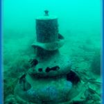
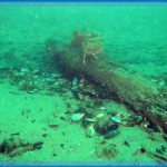
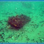
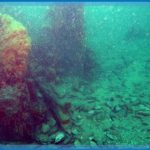
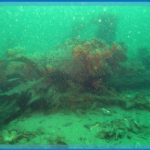
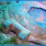
After SOE members had given a talk to a local Melbourne dive club, some of the dive club members located the site and where in the process of removing artefacts from the site. Once informed of this Heritage Victoria, along with the assistance of SOE members raised the remaining items which were thought to be at risk. They were sent to the HV laboratory. With the work on the Channel Deepening Project affecting the shipping channels the SCUD site eventually was excavated completely, by a team of commercial divers.The site is spread out over length of approximately 15 metres by 6 metres with large timbers, piles, large gas cylinders approximately 1.6 metres long being evident. The defining feature suggesting that this was part of the Port Phillip navigation system was a bronze light unit approximately 75cm
high by 60cm wide with the glass prisms having fallen out and located on the seabed nearby. Lying a short distance away was a light copper sheet cap component of the light unit, which could have acted as a chimney for drawing out the smoke. The large rectangular timbers, are very similar in appearance to the timbers used as beams in Gem Pier at Williamstown; they are 12inch x 6inch. If this timber were a frame from a ship, it would be a
vessel of 400-tons. (Australian Lloyds Rules & Regulations 1864) There appears to be a layer of timber on both sides of the vertical timbers, suggesting that
one might be a deck. These have been extensively damaged by teredo. When taking timber samples a great deal of effort was needed to find solid timber that could be taken for analysis. There are four gas cylinders onsite; most likely acetylene, with one isolated at the northern end of the site while there is a group of three lying side by side. It is possible that the northern cylinder had been disturbed, as in the past the area was well trawled by scallop fishermen.
There are large timbers in place that appear to be spaced too far apart to be ship frames and appear more like bearers. The pile-like timbers are 30cm in diameter and lie in a horizontal position, they disappear under the seabed, and as such their length is unknown. There are no fittings, such as rigging or items that could be associated with a ship that could help identify this site as being a lightship.
Acknowledgments
Phillip McAdam – Williamstown Professional Fisherman.
